Neither here nor there in chhit mahal
On 6 June, Bangladesh and India signed the historic Land Boundary Agreement. Originally conceived in 1974, it was aimed at settling long-standing territorial issues between the two countries. The deal includes swapping 200 enclaves – patches of island territories surrounded on all sides by another nation. The residents now have the right to stay where they are or move. In our March 2014 issue 'Reclaiming Afghanistan', Anuradha Sharma reported from one such enclave, exploring the historical and political stories behind these geographies. Here's an extract from the reportage. To read more, you can purchase the print or digital version of the issue.
The town of Cooch Behar, located in the foothills of the eastern Himalaya some 700 kilometres north of Kolkata, was once the seat of the Koch kings. It is now the headquarters of a district, also called Cooch Behar, which was a princely state during British rule in India. With Maharaja Nripendra Narayan's palace here and the Madan Mohan temple there, the town is dotted with historical buildings and heritage sites and is a popular tourist destination in West Bengal.
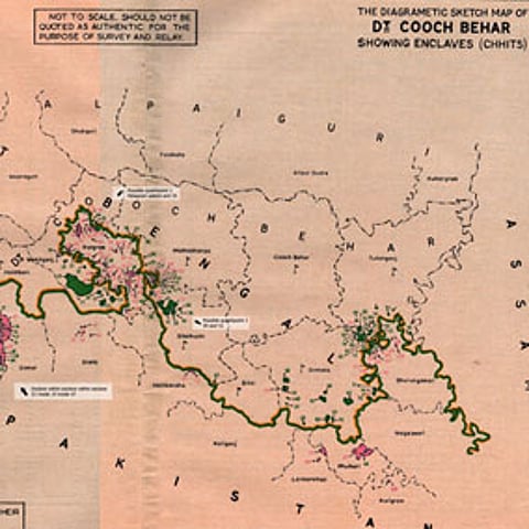
There's a cluster of enclaves in Cooch Behar – Madhya Masaldanga is about an hour-and-a-half's drive from the district headquarters. They are also strewn all over the neighbouring district of Jalpaiguri and the state of Assam. This 'archipelago' of landlocked islands even has 24 (21 Bangladeshi and three Indian) counter-enclaves – i.e. enclaves within enclaves – and also the world's only counter-counter enclave, Dahala Khagrabari. It is an Indian patch of agricultural land, roughly the size of a football field, inside a Bangladeshi enclave, which is within an Indian enclave inside Bangladesh.

